Find the real owner of someone with a 479, 501, 870 Arkansas Area Codes
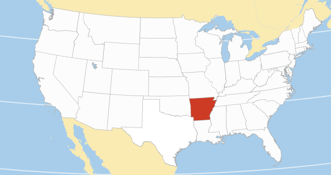
Arkansas is a south-central state that joined the union in 1836 and has since become home to more than three (3) million people. These residents have phone numbers recognizable by an area code, which shows the caller’s general location on the Arkansas phone numbers database.
Arkansas area codes represent the county or city where the phone number owner resides per the North American Numbering Plan (NANP). Generally, when a resident of Arkansas registers a phone number, they will provide a name and contact address, which the mobile carrier links to the phone number.
This information is publicly available with a reverse phone lookup on the Arkansas phone numbers database, and most people use it to find unknown callers.
Generally, when a resident of Arkansas registers a phone number, they will provide a name and contact address, which the mobile carrier links to the phone number. This information is publicly available with a reverse phone lookup on the Arkansas phone numbers database, and most people use it to find unknown callers.
Three features make an Arkansas phone number unique — the area code, the prefix code, and the line number.
Consider the typical Little Rock phone number, 501-AYY-XXXX. Suppose this phone number is a house address where a mailman must deliver an urgent letter. The courier would look at the house address on the parcel and refer to a personal map. The same applies to when you make a phone call; the service provider reads the recipient’s phone number to determine the call destination. How does this phone number search work exactly?
The first set of three digits in a phone number is the area code. It represents a known county, city, or town in Arkansas. So, the mobile carrier knows the call is going to Little Rock—because the city uses area code 501. The next set of three digits, AYY, is the prefix code. You can liken the prefix code to a street name. Finally, the last set of four digits, XXXX, is the line number. These digits are unique to every phone number owner in Arkansas, and you can think of them as a house address or apartment number.
Thus, by reading the entire phone number, the service provider knows the exact call recipient and routes the call accordingly. The same information makes it possible for you to perform a reverse phone lookup and identify the owner of the unknown phone number.
Thousands of persons may have the same area code, and many people may share the same prefix code. However, the line number is unique to only one person. Thus, a reverse phone search on the Arkansas phone numbers database is very reliable. Besides furnishing you with the individual’s phone number and contact details, you will also access publicly available records on the person.
| County | FIPS code | County seat | Established | Population | Area |
| Arkansas County | 001 | Stuttgart, DeWitt | 1813 | 17,149 | 1,033.79 sq mi |
| Ashley County | 003 | Hamburg | 1848 | 19,062 | 939.08 sq mi |
| Baxter County | 005 | Mountain Home | 1873 | 41,627 | 586.74 sq mi |
| Benton County | 007 | Bentonville | 1836 | 284,333 | 884.86 sq mi |
| Boone County | 009 | Harrison | 1869 | 37,373 | 601.82 sq mi |
| Bradley County | 011 | Warren | 1840 | 10,545 | 654.38 sq mi |
| Calhoun County | 013 | Hampton | 1850 | 4,739 | 632.54 sq mi |
| Carroll County | 015 | Berryville, Eureka Springs | 1833 | 28,260 | 638.81 sq mi |
| Chicot County | 017 | Lake Village | 1823 | 10,208 | 690.88 sq mi |
| Clark County | 019 | Arkadelphia | 1818 | 21,446 | 882.60 sq mi |
| Clay County | 021 | Piggott, Corning | 1873 | 14,552 | 641.42 sq mi |
| Cleburne County | 023 | Heber Springs | 1883 | 24,711 | 591.91 sq mi |
| Cleveland County | 025 | Rison | 1873 | 7,550 | 598.80 sq mi |
| Columbia County | 027 | Magnolia | 1852 | 22,801 | 766.86 sq mi |
| Conway County | 029 | Morrilton | 1825 | 20,715 | 566.66 sq mi |
| Craighead County | 031 | Jonesboro, Lake City | 1859 | 111,231 | 712.98 sq mi |
| Crawford County | 033 | Van Buren | 1820 | 60,133 | 604.20 sq mi |
| Crittenden County | 035 | Marion | 1825 | 48,163 | 636.74 sq mi |
| Cross County | 037 | Wynne | 1862 | 16,833 | 622.33 sq mi |
| Dallas County | 039 | Fordyce | 1845 | 6,482 | 668.16 sq mi |
| Desha County | 041 | Arkansas City | 1838 | 11,395 | 819.52 sq mi |
| Drew County | 043 | Monticello | 1846 | 17,350 | 835.65 sq mi |
| Faulkner County | 045 | Conway | 1873 | 123,498 | 664.01 sq mi |
| Franklin County | 047 | Ozark, Charleston | 1837 | 17,097 | 619.69 sq mi |
| Fulton County | 049 | Salem | 1842 | 12,075 | 620.32 sq mi |
| Garland County | 051 | Hot Springs | 1873 | 100,180 | 734.57 sq mi |
| Grant County | 053 | Sheridan | 1869 | 17,958 | 633.01 sq mi |
| Greene County | 055 | Paragould | 1833 | 45,736 | 579.65 sq mi |
| Hempstead County | 057 | Hope | 1818 | 20,065 | 741.36 sq mi |
| Hot Spring County | 059 | Malvern | 1829 | 33,040 | 622.16 sq mi |
| Howard County | 061 | Nashville | 1873 | 12,785 | 595.20 sq mi |
| Independence County | 063 | Batesville | 1820 | 37,938 | 771.57 sq mi |
| Izard County | 065 | Melbourne | 1825 | 13,577 | 584.02 sq mi |
| Jackson County | 067 | Newport | 1829 | 16,755 | 641.45 sq mi |
| Jefferson County | 069 | Pine Bluff | 1829 | 67,260 | 913.70 sq mi |
| Johnson County | 071 | Clarksville | 1833 | 25,749 | 682.74 sq mi |
| Lafayette County | 073 | Lewisville | 1827 | 6,308 | 545.07 sq mi |
| Lawrence County | 075 | Walnut Ridge | 1815 | 16,216 | 592.34 sq mi |
| Lee County | 077 | Marianna | 1873 | 8,600 | 619.47 sq mi |
| Lincoln County | 079 | Star City | 1871 | 12,941 | 572.17 sq mi |
| Little River County | 081 | Ashdown | 1867 | 12,026 | 564.87 sq mi |
| Logan County | 083 | Booneville, Paris | 1871 | 21,131 | 731.50 sq mi |
| Lonoke County | 085 | Lonoke | 1873 | 74,015 | 802.43 sq mi |
| Madison County | 087 | Huntsville | 1836 | 16,521 | 837.06 sq mi |
| Marion County | 089 | Yellville | 1835 | 16,826 | 640.39 sq mi |
| Miller County | 091 | Texarkana | 1820 | 42,600 | 637.48 sq mi |
| Mississippi County | 093 | Blytheville, Osceola | 1833 | 40,685 | 919.73 sq mi |
| Monroe County | 095 | Clarendon | 1829 | 6,799 | 621.41 sq mi |
| Montgomery County | 097 | Mount Ida | 1842 | 8,484 | 800.29 sq mi |
| Nevada County | 099 | Prescott | 1871 | 8,310 | 620.78 sq mi |
| Newton County | 101 | Jasper | 1842 | 7,225 | 823.18 sq mi |
| Ouachita County | 103 | Camden | 1842 | 22,650 | 739.63 sq mi |
| Perry County | 105 | Perryville | 1840 | 10,019 | 560.47 sq mi |
| Phillips County | 107 | Helena | 1820 | 16,568 | 727.29 sq mi |
| Pike County | 109 | Murfreesboro | 1833 | 10,171 | 613.88 sq mi |
| Poinsett County | 111 | Harrisburg | 1838 | 22,965 | 763.39 sq mi |
| Polk County | 113 | Mena | 1844 | 19,221 | 862.42 sq mi |
| Pope County | 115 | Russellville | 1829 | 63,381 | 830.79 sq mi |
| Prairie County | 117 | Des Arc, DeValls Bluff | 1846 | 8,282 | 675.76 sq mi |
| Pulaski County | 119 | Little Rock | 1818 | 399,125 | 807.84 sq mi |
| Randolph County | 121 | Pocahontas | 1835 | 18,571 | 656.04 sq mi |
| St. Francis County | 123 | Forrest City | 1827 | 23,090 | 642.40 sq mi |
| Saline County | 125 | Benton | 1835 | 123,416 | 730.46 sq mi |
| Scott County | 127 | Waldron | 1833 | 9,836 | 898.09 sq mi |
| Searcy County | 129 | Marshall | 1838 | 7,828 | 668.51 sq mi |
| Sebastian County | 131 | Fort Smith, Greenwood | 1851 | 127,799 | 546.04 sq mi |
| Sevier County | 133 | De Queen | 1828 | 15,839 | 581.35 sq mi |
| Sharp County | 135 | Ash Flat | 1868 | 17,271 | 606.35 sq mi |
| Stone County | 137 | Mountain View | 1873 | 12,359 | 609.43 sq mi |
| Union County | 139 | El Dorado | 1829 | 39,054 | 1,055.27 sq mi |
| Van Buren County | 141 | Clinton | 1833 | 15,796 | 724.32 sq mi |
| Washington County | 143 | Fayetteville | 1828 | 245,871 | 951.72 sq mi |
| White County | 145 | Searcy | 1835 | 76,822 | 1,042.36 sq mi |
| Woodruff County | 147 | Augusta | 1862 | 6,269 | 594.05 sq mi |
| Yell County | 149 | Dardanelle, Danville | 1840 | 20,263 | 948.84 sq mi |